Backup Only

This Week's Walks - Archive

Please see the Saturday Walker's Club This Week's Walks page.

This is an archive of walks done by the Saturday Walker's Club. You should only need to use this page if the SWC website is down.

Sunday, 30 July 2023

Sunday Walk – Wadhurst Figure-of-8, via Bewl Water

Extra Walk 5c – Wadhurst Figure-of-8, via Bewl Water

Length: 18.7 km (11.6 miles), with longer and shorter options. Toughness: 6/10

10:09 Hastings train from Cannon Street (London Bridge 10:13, Orpington 10:41, etc), arriving Wadhurst at 11:21.

† There are no trains from Charing X and Waterloo East because of engineering works.

Return trains from Wadhurst are at xx:02 & xx:30 to 20:30, then hourly.

Bewl Water 
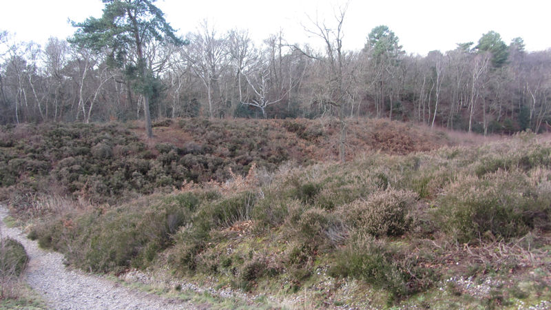
The Short Walk options in Book 2 no longer get many postings but the Wadhurst one combines well with the second half of the Bewl Water walk to make a nicely varied outing. Although part of the afternoon leg is alongside the reservoir, this is a distinctly hilly part of the High Weald and the walk's saw-tooth height profile shows hardly any flat sections, hence the 6/10 rating.

After about two hours you'll have looped round to Wadhurst where there should be a fair choice of refreshment places: there are two pubs in the village (the White Hart and the Greyhound) and several cafés, with both Hatters and La Petite France claiming to be open on a Sunday. For the afternoon I suggest the ‘Main Walk’ loop of the Bewl Water walk, but you could do its ‘Long Walk’ option (an extra 2.6 km) or simply complete the Book 2 Short Walk.

If you do either of the Bewl Water loops you'll find yourself back in Wadhurst where its two pubs now function as tea stops, since the cafés will probably have closed for the day. As most of you will know, it's about 2.3 km down the main road to the station but the walk directions offer a much nicer amble along back lanes which is only 1 km longer.

You'll need to bring the directions from the L=2.18.a page (for the morning) and the Wadhurst via Bewl Water Circular walk (for the afternoon). Note that the distances (and toughness) for the Book 2 walk are understated; the Wadhurst Short Walk is 11.3 km (not 10) and so the Figure-of-8 walk options are also about 1 km longer than stated.

Sunday walk - Box Hill to Leatherhead

Length: 11.5m km (7.1 miles)

Difficulty 7 out of 10

Trains: 10.02 train from London Waterloo (Clapham Junction 10.12), arriving Box Hill and Westhumble at 10.51.

Return trains from Leatherhead xx.15, xx.21, xx.45 and xx.51

Buy a return to Box Hill and Westhumble.

This is a short but hilly walk with a strenuous morning an a gentler afternoon.

Lunch: There are two pubs in Mickleham - The Running Horses and the King William IV.

Tea: There are some cafes in the shopping centre in Leatherhead. See directions for more details.

L=1.49


Saturday, 29 July 2023

Exploring the Shirley Hills (new walk)

Lloyd Park to Coombe Lane

Length: Length: 14.2km km (8.8 miles). Toughness: 3/10

Take a London Tram to arrive at Lloyd Park at 11.00. Meet at the cafe just inside the entrance to Lloyd Park (turn right coming off the Tram from Croydon then left after a few metres to enter Lloyd Park. The cafe is just on the right). Trams run to Lloyd Park from West or East Croydon (New Addington service) and from New Addington, Beckenham Junction, Elmers End and Wimbledon. See the Tram Map for more detail.

London buses also run to the start and end of this walk

Lloyd Park and Coombe Lane are both within London Zones so you can use Oyster or Contactless.

Heather on Addington Hill (image courtesy of croydoncentralparks website) This map-led walk explores parts of the Shirley Hills and is mainly through parks, heathland and quiet woodlands, where deer are sometimes seen. It's fairly short but there are some ups and downs to work the leg muscles. It climbs up and across Lloyd Park then explores the woodland and heathland of Addington Hill, a Site of Nature Conservation Interest, which is looking especially nice at the moment as the heather is beginning to flower. The walk then leads you through Heathfield House gardens, Bramley Bank Nature Reserve (home to stag beetles and woodpeckers) and Littleheath Woods. Then it's on to the ancient enchanted wood of Croham Hurst and Breakneck Hill, a Site of Special Scientific Interest with a Bronze Age Barrow and a view to the south from the top. From there, the walk takes you around Coombe Wood, where there are ornamental gardens, a small woodland and a cafe, before a final stretch along Addington Hill to Coombe Lane.

There are plenty of nice spots for a picnic lunch on the route. Alternatively refreshments are available at:

Lloyd Park Cafe in Lloyd Park. 020 8633 1633 This is right at the start of the walk but you could probably get a take-away.

The Royal Garden Chinese restaurant on the top of Addington Hill. Shirley Hills Road, Croydon CR0 5HQ 020 8654 0170. Booking essential. You pass it early along the route but you could circle back there at the end of the walk.

The Coach House Cafe in Coombe Wood, near the end of the walk. 020 8686 8914. Serves hot meals as well as cakes, ice creams etc...

Remember to bring the map and/or GPS route, which can be downloaded from the L=swc.411 page.

Saturday Walk - Oxted Circular

Length: 19½ km (12.1 miles). Four hours 45 minutes walking time. 5 out of 10.

Longer, after lunch option, via Chartwell: 22¾ km (14.1 miles)

"Much of this walk is on the wooded Greensand Ridge running parallel to and just south of the North Downs. At various points in the walk there are views across the valley to these downs, contrasting with far-reaching views out to the High Weald from the southern escarpment.

The outward route is across the National Trust's Limpsfield Common, the High Chart and Squerryes Park. This brings you to Westerham, described by Daniel Defoe as a “neat, handsome, well-built market town”. Quebec House owned by the National Trust' is open Wed–Sun afternoons from mid-March to October; admission is £7 (2022).

The afternoon route climbs onto the wooded Crockhamhill Common, from where an optional extension loops out to Churchill's family home Chartwell, also owned by the National Trust. The garden and restaurant are open throughout the year, but the house is only open from March to October; admission is £20 or £14 for the garden only (2022). "

Trains: With another strike day, there is only an hourly service, but it was running last weekend and there is a pub next to the station to while away the time on your return. Get the 0950 East Grinstead train from Victoria (Clapham 0957, East Croydon 1010) arriving 1032. Return trains to Victoria xx27.

Lunch: In Westerham after 9km (5.6m), various options. The Kings Arms Hotel (01959-562990) is a Greene King pub and the Grasshopper on the Green (01959-562926) is a free house advertising local beers, and the George & Dragon has been revamped (01959-928414). 

Tea: Various cafes and Wetherspoon's pub, the Oxted Inn next to the station.
T=swc.63

Wandering in the Weald from Balcombe to Horsham

SWC 312:  Balcombe to Horsham T=swc.312

Distance:         17 miles/27 km OR 13 miles/21 km if taking the short cut

Difficulty:         7 out of 10

Transport:        Take the 9:35 AM Brighton bound train from London Bridge (9:49 East Croydon), arriving 10:16. Return trains from Horsham are at 04; 20; 34 and 50 past the hour until 22:04. Either buy a day return to Balcombe and sweet-talk the station master in Horsham to let you through the barrier or buy a single from Horsham to Three Bridges for a return to London Bridge, or buy a day return to Horsham (Balcombe does not have barriers) and potentially explain to the conductor that you want to walk from Balcombe to Horsham.

Apologies for the late posting – but have been regularly checking the journey planner and Thameslink website for scheduling confirmations. Based on this inspection, it would appear that Thameslink will be running two trains an hour to Brighton that stop in Balcombe….so fairly confident on outbound journey……With usually 4 trains an hour from Horsham to London – some of them should be running well into the evening and the Thameslink website claims to be running at least two an hour. However, wise to double check the schedules and be flexible on your approach to travel!

This interesting walk traverses the weald from Balcombe to Horsham and explores several water features. On your journey, you will cross the watershed between the Thames and the Channel. More information about the walk and the instructions can be found here.

Lunch:  The quirky Wheatsheaf about 6 miles/10 km into the walk.

Tea: Various team rooms and pubs in Horsham. The Cafe No 4 in Market Square (closing at 16:30) is recommended, though it is difficult to get there in time. For stronger stuff, the Black Jug which you pass on the way to the station is also recommended.

Enjoy the walk!

Thursday, 27 July 2023

Evening Walk: Queen Elizabeth Park (AKA Olympic Park) Exploration

An Evening Exploring the Former Olympic Park and Surrounding Areas t=short.27

Distance:         Approximately 5.3 or 5.8 miles or 8.5 or 9.3 km for those more metrically minded

Difficulty:       1 out of 10

Meet:               18:30 at Robert, the heritage train engine in the forecourt of Stratford DLR/Tube/Mainline Station (town side), see walk notes for instructions if unsure

Return:             Stratford DLR/Tub/Mainline Station

This is an easy and varied walk exploring the former Olympic Park and its surrounding areas, Hackney Wick and Fish Island. The area is continually transforming and has changed a fair bit since the Olympics. It is part urban development with sports facilities and part varied parkland with gardens and wetlands. Leaving the Olympic Park, the route then explores neighboring Hackney Wick and Fish Island, formerly industrial areas, now the home of artists and microbreweries, before returning to Stratford.

Plenty of options in Hackney Wick and back at Stratford for refreshments.

More information about the route can be found here.  

Enjoy the walk!

Wednesday, 26 July 2023

Wednesday walk - Watton-at-Stone Circular

Length:20km (12,4 miles). There is an option to shorten the walk by 3.3km to 16.7km.

Difficulty: 2 out of 10

This walk is in the rolling hills of rural Hertfordshire.

Trains: The national rail website suggests taking the Victoria line to Finsbury Park to catch the 10.22 Stevenage train to Watton-at-Stone, arriving 11.05.

Return trains from Watton-at-Stone are at 15:07, 15:35, 16.05, 16.37, 17:05, 17.35. with later trains following a similar pattern.

Lunch: The Boot pub in the village of Dane End ( 7.8 km from the start of the walk) (077 2508 5693)

Tea: The Bull 113 High St, Watton-at-Stone, SG14 3SB (01920 831032) or 

        The George and Dragon 82 High St, Watton-at-Stone, SG14 3TA (01920 830285)

l=swc.94

Sunday, 23 July 2023

Saunderton Circular via Bledlow

11.7 miles, 18.3 km.
A shorter 6.1 mile walk to Princes Risborough is  possible.
Toughness: 6 /10
A favourite Chilterns walk, with a favourite pub thrown in. There are many fine views out over the valley and plain. Largely gentle but there are one or two steep bits.
Trains: Get the 9:53 Aylesbury train from Marylebone arriving Saunderton 10:51.
Trains back from Saunderton at xx:57 from platform 2 .
Get a return to Saunderton – or for a choice of endings, to Princes Risborough.
3 trains an hour from Princes Risborough at xx:11 xx:22, with a slower train at xx:51
Lunch: The Lions of Bledlow: 01844 343345 nice choice of beers, extensive menu. Open from 12
Bledlow's Lyde Garden is worth a quick visit and is a possible picnic place. The entrance is near the church.
Tea, Saunderton: The Golden Cross is handy for Saunderton station.. It’s on the main road, just past the station turn-in. An earlier possibility is the Boot.
Tea, Princes Risborough:  As you near the end of the Princes Ris directions,  following the  “i into Princes Risborough” choice would bring you to the Bird in Hand 01844 345602  on the far side of the station.
Directions: available here 
To take the shorter ending to Princes Risborough from Bledlow, change to the directions on the separate “Finish in PR”button. 
 T=2.2

Sunday Walk: Overton Circular

Main walk :18.4km 11.6 miles with pub lunch
Shorter walk: 13.8km 8.6 miles (picnic lunch)
Difficulty 4/10

 A Hampshire walk passing several quaint churches, country houses and the source of the River Test. Some locations are associated with Jane Austen. Water buffalo don't feature strongly in her works but you are likely to see some at Laverstock Park Farm. .(between points 57 and 61).
Trains:
Get the 09:35 Weymouth train from Waterloo (Clapham Jct. 9:45) and change at Basingstoke for the Salisbury train (arr. 10.28 dep. 10:33 plat 1) arriving Overton at 10:42 .
Trains return to Waterloo at xx:17. Those earlier than 17:17 require a change at Basingstoke, later ones are direct. After 19:17, there’s a gap till the 20:54.
Lunch.
Steventon churchyard, where Pa Austen was vicar, makes an ideal picnic location on the shorter walk.
The full walk takes you to the Fox in North Waltham 01256 397 288   or, straying further, the Wheatsheaf  01256 398 282. After lunch, you can either retrace your steps back to Steventon or, for variety, return along a quiet road.
Both versions also pass what used to be the lunch pub. It closed for a long while but reopened as the Palm Brasserie, possibly an option but more restaurant than pub. You would most likely need to book. 01256 518160
Tea:  The White Hart 01256 771 431 in Overton does tea. Allow 20 mins to reach the station from Overton. The deceptively named Station Road is 1.2 km long.
Directions: available here 
T=SWC.97


Saturday, 22 July 2023

Saturday Walk: Shoreham Circular (Figure-of-8)

12.4 miles / 20 km - Main Walk
(Both loops of this walk can be shortened to give a total walk of 9.4 miles.  You can also finish a few miles early at Otford, or after lunch at Shoreham).

If you missed the evening walk last week, here is another chance to catch the lavender fields at Castle Farm (if there's no lavender left in the fields, you can find it in the shop).

The morning (northern) loop takes in both Lullingstone Park and Castle Farm, before heading back to Shoreham for lunch.  The afternoon (southern) loop heads down to Otford, from where you can return along the valley, or take a more energetic route through wooded hills back to Shoreham.

Trains: 10:16 London Blackfriars, (10:19 Elephant & Castle), 11:15 Shoreham.  Return trains from Shoreham at xx:02 - due to strike action the last trains are at 17:02 and 18:02 (or 3 minutes earlier at Otford).

Lunch: Shoreham has several eating places:  The Crown  (01959-522903) is at the northern end of the High Street, the King's Arms (01959-523100) is in the centre of the village, nearby is The Mount Vineyard (01959-524008) with a restaurant serving pizzas and sharing boards; and near the church is The Samuel Palmer (07508-440027), an up-market pub/restaurant replacing Ye Olde George Inn.

Tea: As well as the above, there are a couple of tea shops in Shoreham High Street and one at the Aircraft Museum.  Otford also has a choice of tea shops and pubs.

Riddlesdown to Coulsdon South or Kingswood

Length: 16.8km (10.4 miles), with shorter option of 12.5km (7.8 miles): 15km (9.3 miles to Kingswood T=2.15

9.50 train from Victoria (9.57 Clapham Junction, 10.10 East Croydon) to Riddlesdown, arriving 10.18.

This walk is within zone 6, so use Oyster, contactless, passes etc

For walk directions click here (for the Kingswood ending click here), for GPX click here, for a map of the route click here.

Looking for something to cater for the Clapham Junction/East Croydon crowd on this RMT strike day, I was surprised to find that Southern/Thameslink are operating a remarkably comprehensive service, with trains apparently operating late into the evening on many routes. (Future RMT strike day posters might like to note this...). I was therefore tempted to post something further afield....but the weather looks disappointing and so walkers might prefer something closer to civilisation.

Often posted as a short walk in the winter months, this walk actually deserves a summer outing. It crosses plenty of patches of downland which should be awash with flowers at this time of year, even if the butterflies that would normally accompany them at this time of year might be put off by the rain.

Lunch is at the large, but always busy Fox after 3.9 miles. After lunch the main walk loops up to the North Downs Way, but you can short cut that by going directly to Happy Valley, cutting the walk to 7.3 miles. If you combine this short cut with the alternative ending in Kingswood, the walk is 9.3 miles

Tea is limited to a park cafe (which might not be open if it is wet) in Coulsdon South. In Kingswood there is the Kingswood Arms by the station

Trains back from Coulsdon South are at 27 and 57 past to London Bridge or 49 past to Victoria **, with more options if you change at East Croydon.

Trains back from Kingswood are at 18 past **, a shuttle to Purley today, where there is an 11 minute wait for a London-bound train. 

*** All these trains run until well into the evening, according to the National Rail journey planner, which has supposedly been updated with the strike timetable, but check on the day just to be sure.

Chesham Circular via The Lee

Length: 16.1 km (10 miles). Toughness: 3/10 

Another Saturday another train strike. 

This is a variant on the often walked Chesham circular walk. Essentially follow the standard Chesham to Great Missenden walk to the Cock and Rabbit PH (under new ownership) , The Lee. After lunch continue with the directions until [6] to then use the Chesham Circular directions picking up the text at ii) From The Lee to Chartridge. 

Catch the 9:49 Metropolitan line train from Baker Street (Aldgate: 9:33), arrives Chesham 10:48. 

 L=2.4.b

Friday, 21 July 2023

Patriots at the Noel Coward Theatre

After a success run at the Almeida Theatre,  Patriots is tranferred to the Noel Coward Theatre for a limited time.  It had very good reviews.  

To book, please click here.  This is the Almeida's official booking site.  I found it is also the cheapest without booking fees.  There are a number of websites you can book this play,  so do shop around if you wish. 

Pre-theatre F&B will be at Cafe in the Crypt,  St Martin in the Fields.  For details,  please click here.   Meet at the Cafe from 5:45pm.  It is a short walk from the theatre,  We plan to leave here at 7:10pm. 

1991. The Fall of the Soviet Union.

With the dawning of a new Russia, there are winners and losers, and today’s patriot can fast become tomorrow’s traitor.

As a new generation of oligarchs fights to seize control, Patriots follows billionaire businessman Boris Berezovsky from the president’s inner circle to public enemy number one.

BAFTA-winning Tom Hollander (The Night Manager, Travesties) plays as Berezovsky, the ‘kingmaker’ behind Vladimir Putin, with Will Keen (His Dark Materials) as Putin, and Luke Thallon (Albion) as Abramovich.


Thursday, 20 July 2023

Evening Walk - The Wandle Trail and the Thames Path (Colliers Wood to Putney or Hammersmith)

Length: 8.8 km (5.5 mi) [longer to Hammersmith]
Net Walking Time: 2 hrs  
 
Meet: Colliers Wood Station at 18.45 hours. Colliers Wood is on the Northern line in Zone 3, and a 26-minute journey from Bank.
Finish: either at Putney Bridge station (District Line) or at Putney Mainline (trains to Waterloo). You can also walk on to Hammersmith (Piccadilly, District and Hammersmith & City lines). 
Drop-Outs: Haydens Road station, Earlsfield station, Wandsworth station.

This walk follows the last 6 km of the River Wandle Trail in south west London to the River Thames, then follows a pretty stretch of the Thames Path through Wandsworth Park to Putney. The walk finishes at a large riverside pub, with options to continue along the Thames Path or explore 2 more riverside parks. The Wandle Trail section is a mix of paths alongside a narrow river, small urban parks and open spaces (some nice, some unkempt) passing back gardens and some industrial areas. The Trail is waymarked, but mainly for cyclists (blue signs with a water wheel for cyclists, green signs with a water wheel for walkers). The route is being improved over time as former industrial areas are gentrified. The river has an interesting industrial heritage, it has a very steep gradient, so it was channelled to drive water wheels, now the route's symbol.


Eat/Drink: By Putney Bridge there are two riverside pubs, with a terrace - a Wetherspoon’s and a Young’s.

For walk directions, map, photos, and gpx/kml files click here. T=short.25

Wednesday, 19 July 2023

Benfleet circular

Length: 15.2 km (9.5 miles) or 18.6 km (11.6 miles) including One Tree Island. 4/10

A walk of contrasts - first through the hilly woodland of the Benfleet Downs, then through Hadleigh Country Park with the magnificent vantage point of Hadleigh Castle, then down to Leigh-on-Sea and back along Benfleet Creek, passing One Tree Island (possible interesting out-and-back circuit) and Barge Gladys (quirky tea stop).

Travel: 1004 from Fenchurch Street (West Ham 1013) arriving at Benfleet 1046. Around 5 return trains an hour.

Lunch: various places in Leigh-on-Sea; the Crooked Billet (01702 480289) is regarded as the best pub but is very popular. For a picnic, Hadleigh Castle is a fine spot.

Tea: as mentioned above, a quirky establishment called the Barge Gladys is about 400m before Benfleet Station. This is a converted barge with a pub garden, moored on the north side of Benfleet Yacht Club. It is popular with walkers, cyclists and boating people.

There are other refreshment opportunities in the High Street beyond Benfleet station. The Hoy and Helmet (01268 792307) has received good reviews but I haven't been there.

Short walk option: You could just walk the morning section of the walk to Leigh-on-Sea (8.9km, 5.6m), have lunch there and then spend the afternoon exploring Leigh-on-Sea or going to the small beach which is about 1 km beyond the station. You will need a return to Leigh-on-Sea. 

For walk directions, map and GPX click here

PS . . . I'm going to be away for my slot on 16 August so would particularly welcome any requests if someone has an idea for that day. Please add to the Walk Requests thread.    

T=swc.268


Monday, 17 July 2023

Ventnor to Shanklin - over Boniface Down [Isle of Wight weekend]


Ventnor to Shanklin

Length: 4 miles

Toughness: 6 out of 10

Start: walk starts at Ventnor Boots Bus Stop at 10 am

For GPS and further information see here: https://www.walkingclub.org.uk/walk/lake-to-shanklin/index.html

t=swc.369

Island Line trains Back to Ryde:  xx.14 and xx.57 mins

The walk will be back over Boniface Down, Bonchurch Down, Luccombe Down, Shanklin Down and into Shanklin and the railway station.

Alternatively, you can do the Friday walk along the landslip in reverse to get back to Shanklin.

There is a tea room at the railway station for refreshments.  Many other  refreshment places in Shanklin itself for cream teas, fish and chips and lunch.


Sunday, 16 July 2023

Ventnor to Godshill [Isle of Wight weekend]

Length: 12.6 km (7.9 miles).

Toughness: 6 out of 10. Some steep bits but nice views.

Map Walk: There are no written directions for this walk, only a GPS route.

For GPS: t=swc.410

Features

The walk will take us along St Boniface Down and then a climb up the very steep path to Bonchurch Down, across Wroxall Down and past the Radio Station viewpoint. The walk then takes you across Stenbury Down and into the grounds of Appuldurcombe House. After looking around the hollowed-out rooms and possibly picnicking in the grounds we will walk into Godshill village for tea. After that you can return by bus to Ventnor or Shanklin or walk back.

Travel

Start at the Bus Stop by the Central Car Park, High Street, Ventnor at 10.30am.

Return Buses from Godshill Hollies:

  • No.2 to Shanklin (15 minutes) or Ryde (1 hour). These leave at around xx:06 & xx:36; last bus 18:05 Sun, 18:35 Mon–Sat.
  • No.3 to Ventnor (20 minutes), Shanklin (40 minutes) or Ryde (1 hour 20 minutes). These leave at around xx:23 & xx:53 to late evening, then hourly.

Eating

Lunch: There is nowhere to buy any food on this route until Godshill village, so please bring a picnic which can be eaten in the grounds and parkland of Appuldurcombe House. Note that there are no toilets in the house or grounds.

Tea: There are plenty of tearooms and pubs in Godshill Village.

Points of Interest

Appuldurcombe House: This early 18th century house was the seat of the Worsley family, and once the greatest house on the Isle of Wight built in the English Baroque style. Sir Richard Worsley, the 7th baronet, gained notoriety for a 1782 court case in which his wife, Seymour, admitted to having had 27 lovers. The house is now just a shell, and you can walk through the rooms which have information boards. House and Grounds are free.

Godshill Village: A very picturesque village with a medieval church, thatched-roofed cottages and a winding main street lined with traditional tearooms and pubs. There is also a famous Model Village.

Sunday Walk – Fleet Circular

Extra Walk 318 – Fleet Circular

Length: 19½ km (12.1 miles). Toughness: 4/10

10:07 Basingstoke & Alton train from Waterloo (Clapham Jct 10:15, Wimbledon 10:22), arriving Fleet at 11:04. You need to be in the portion for Basingstoke (usually the front half).

Trains back from Fleet are half-hourly at xx:02 & xx:32. These pause at Woking to allow the Alton train to attach, and on the xx:32 it looks like you can save 10 minutes by nipping across to Platform 2 for a faster train (CLJ & WAT only).

Levada This walk is somewhat longer than I'd usually pick for a Sunday, but it's not tough and there are long shady sections alongside Fleet Pond and the Basingstoke Canal which will help on the off chance that it's a hot sunny day. There's also a long stretch through heathland and woodland in a large MoD training area, including a hill where you walk alongside a water channel faintly reminiscent of a Madeiran levada.

There are several possible lunch pubs on or around the walk route, but the one closest to the walk's midpoint has sometimes had a rather limited food menu. If you definitely want a pub lunch, check the walk notes and decide which one you fancy. If you bring your own provisions you'll find the pubs are well spaced out and make good watering-holes, with the final one being just across the road from the station.

You'll need to bring the directions from the L=swc.318 page. There are several places where the walk notes offer an alternative route, so don't be surprised to see some adventurous souls deviating from the GPS route.

Saturday, 15 July 2023

Chale to Ventnor walk [Isle of Wight weekend]


This walk was devised by Sylvia Cummins, who sadly died suddenly in 2022. She loved the Isle of Wight and organised a trip there at least once per year, including this walk from Chale to Ventnor.

This GPX-only walk (i.e., no written directions) explores the South of the Isle of White

Starting at Chale Church with a (optional) climb up to the St Catherine’s Oratory, the route then descends to the coast path near Blackgang Chine.  The Coast path is inland at this point but gives views down to the sea and St Catherine’s Lighthouse with an opportunity to swim at a deserted beach, Rocken End, which can be difficult to access following rain.  You then climb back up to civilisation and lunch at the Buddle Smugglers Inn near Niton.

After lunch the route climbs up to the Coast path which runs at high level above the Landslip then descends through St Laurence to the Sugar Loaf Hill and a more normal cliff top coast path.  This leads to the hamlet of Steephill Cove where you can get tea and ice cream.   The route into Ventnor takes you pass the Spyglass Inn and several seaside cafes as well as the part sand part gravel beach.  There are several restaurants in Ventnor and regular busses back to Shanklin and Ryde.

Conditions on coastal walks are particularly liable to change and you might need to divert off your intended route. A GPS device is recommended.

toughness: 6 out of 10

Length: 8.5 miles

Travel:  Bus Number 6 departs Ventnor Boots at 10.05  (direction Newport ).  Arrives Chale Church at 10.41.  (This is a 2 hourly service).

For those starting from Shanklin (Bus no. 3 leaves Shanklin Bus station Stand D, at 9.33 and gets to Ventnor Boots by 9.53).  An earlier bus No. 3 leaves Bus Station at 9.03 and arrives Ventnor 9.23.

This is a map led walk, and the GPX and KML files can be found here along with outline of the walk, swimming spots, sites, picnic places, pubs  etc:

https://www.walkingclub.org.uk/walk/chale-to-ventnor/

  t=swc.405


Saturday Walk - Balcombe Circular - Nymans Gardens (NT)

Length: 17.6km (10.9 miles), 5 hours walking, 5 out of 10

"This walk is full of small delights: a nature reserve and lake with Japanese pavilion down by the stream below the impressive gardens and park of Nymans (National Trust) with its part-ruined manor house; a churchyard in Slaugham (pronounced 'Slaffam') with a 600-year-old yew tree some 10 metres in circumference; the ruins of Slaugham Manor; then a walk down to the River Ouse."
You should use the online directions in order to get the route to a tunnel under the A23 (motorway)

Trains: Get the 1005 Thameslink Brighton train from London Bridge (St Pancras 0950, East Croydon 1019) arriving 1046. Return trains are xx25 xx55.

Lunch: is normally early in Handcross at the Red Lion, after 3.5 miles, 5.6km. After 7.6km there is the Heritage in Slaugham, an altogether more upmarket place.
After 7.5 miles, 12km (3 hours) you get to Staplefield and The Victory Inn (tel 01444 400 463) all day at weekends. Late lunch or early tea. On the other side of Staplefield Green, some 300 metres north of the Victory Inn, The Jolly Tanners (tel 01444 400 335), a family run village pub with a pleasant beer garden. This gives you only 3 miles left to get to the station.

Tea:  The Half Moon, an excellent community pub.
T=1.16

Saturday Walk - Over the South Downs to the Sea: Lewes to Seaford or Bishopstone via West Firle

Length: 22.3 km/13.9 mi [shorter options available, see below]
Ascent/Descent: 511/507m
Net Walking Time: ca. 5 ¾ hours
Toughness: 6 out of 10 

Take the 09.54 Eastbourne train from Victoria (Clapham 10.01, EC 10.10), arrives Lewes at 10.56. 
From London Bridge, the latest connecting train is the 09.51 Thameslink to 3 Bridges: change at East Croydon (10.06/10.10). 
Return trains are on xx.25 and xx.53 (change at Lewes). 
Buy a Seaford (Sussex) return.
 
From Lewes, the route takes a variation of the familiar south easterly route out of Lewes: cross the River Ouse in the town centre and climb a lane to a golf club car park. You then follow a circular ridge route, with glorious views throughout followed by a long descent into Glynde. From Glynde station, go through the village to cross over the A24 and pass Preston Court Farm. You go through the entrance to Firle Park, cross a field and enter the village of West Firle for lunch and drinks at the Ram Inn.
Continue through West Firle to start a long climb up to a spot near Firle Beacon. Head westerly to the transmission masts on Beddingham Hill and descend with glorious views to the seafront promenade in Bishopstone and on along the coast to Seaford. 

You have four options for shortening the walk:
Lewes to Seaford omitting West Firle 18.6 km (11.6 m);
Glynde to Seaford via West Firle 16.8 km (10.5m);
Glynde to Seaford omitting West Firle 12.5 km (7.8m);
Finish at Bishopstone station (cuts 2.0 km). 
 
Lunch: The Ram Inn in West Firle (9.0 km/5.6 mi, food to 15.00, bar menu all day). A (small) table is booked for 12.45. 
Tea: Salts Café. Stronger stuff can be at The Old Boot Inn, The Old Plough and The Wellington. There is also Steamworks, the lovely pub in the station waiting room. 

For walk directions, maps, height profiles, photos and gpx/kml files click here. T=swc.181