Backup Only

This Week's Walks - Archive

Please see the Saturday Walker's Club This Week's Walks page.

This is an archive of walks done by the Saturday Walker's Club. You should only need to use this page if the SWC website is down.

Saturday, 23 April 2016

Saturday Third Walk - Tisbury Circular (via Ludwell and Berwick St. John)


SWC Walk 251 – Fine views in the undulating Upper Nadder Valley, Wardour Park and its ruined Castle, a long ascent to Win Green, views to the coast and nearby valleys, White Sheet hill and ridge, a rough descent, a jump over a boggy brook, a bluebell wood (at least one, anyway)

Length: 26.3 km (16.4 mi) [shorter option available, see below]
Ascent/Descent: 710 m; Net Walking Time: ca. 6 ½ hours
Toughness:  10 out of 10

09.20 Exeter St. Davids train from Waterloo (Clapham J. 09.27, Woking 09.46), arrives Tisbury 11.06.
Buy a £15 day return to Tisbury on the SWT-website or at the station ticket office (but not the machines) before midnight the night before.
Returns are at xx.01, last train 22.03.

The walk explores parts of the Upper Nadder Valley (also known as the Vale of Wardour) in the south westerly parts of the West Wiltshire Downs Area of Outstanding Natural Beauty, which is spectacular walking country with some breathtaking views. Heading west from Tisbury, initially it broadly follows the valley, while never being flat for long, before routing through Wardour Park with its large neoclassical mansion and romantically ruined 14th century Castle to then bypass the Donheads via a hill crossing.
After lunch in Ludwell it is a long and steady ascent to South Wiltshire’s highest point: Win Green Hill, providing for 360°-views to the coast and the inland valleys. After a stretch along the Cranborne Chase ridge a steep descent into the Chalke Valley is followed by a re-ascent up Berwick Coombe to White Sheet Hill, followed by a steep and rough descent from the chalk escarpment.  A few woods, a boggy brook crossing and some smaller copses are followed by the descent back into Tisbury, a remarkably unspoilt village.
A Shortcut (17.2 km, 440m ascent), limiting the effort to 5/10, is described.

On the full walk the lunch stop is The Grove Arms in Ludwell (10.6 km/6.6 mi), just before the ascent to South Wiltshire’s highest point.
On the short walk the lunch stop is The Forester Inn in Donhead St. Andrew (7.3 km/4.5 mi), an excellent yet welcoming pub restaurant. Pre-booking is advised. 
Back in Tisbury the options are the highly recommended Beatons Tearooms and Bookshop for tea, or one of three pubs – in (my) order of preference: The Boot Inn, The South Western or The Bennett.
For walk directions click here. For summary, route map, height profile, photos and gpx/kml files click here.

Get Hill Fit for Ullapool – The Schedule
23/04 – SWC 251 Tisbury Circular (via Ludwell and Berwick St. John)
30/04 – SWC 239 Halnaker to Chichester (via Cass Sculpture Park and Goodwood)
07/05 – SWC XXX (New Walk) Haslemere to Midhurst
14/05 – SWC 068 (Revised) Rowlands Castle Circular
T=swc.251

Saturday Second Walk - Bluebell Blockbuster (and maybe apple blossom)

SWC Walk 41 - Yalding to Sevenoaks
Length: 21km (13 miles) but see Shortening the walk below
Toughness: 5 out of 10

9.10 train from Charing Cross (9.13 Waterloo East) to Paddock Wood, arrive 9.58, changing there (same platform) for the 10.11 to Yalding, arrive 10.19

If you just miss the above, the 9.15 from Charing Cross (9.18 Waterloo East) connects with the Yalding train at Tonbridge (arrive 9.57, depart 10.04)

Buy a day return to Yalding.

For walk directions click here.

There are bluebell woods throughout this gentle Kentish walk, and if they are not fully out by now they damned well ought to be. You also pass through a varied "Garden of England" landscape, including one or two cute villages, the occasional stately home and some apple orchards (which may be in blossom by now, but don't hold me to it: apple blossom is fickle in its timing).

Perhaps best of all in the light of recent pub debacles, this walk has THREE possible lunch pubs, each one a cracker. (They surely can't ALL be "fully booked".) The early train (in case you were thinking of moaning) is chosen to give you a reasonable choice of them, the latter two being 6 miles and 7.4 miles into the walk respectively.

Tea options include Ightham Mote early in the afternoon or rushing on to Knole Park (which only has a kiosk at present). But it is a shame to rush the part of this walk between these two National Trust properties, as it is a lovely stretch, with fine views, interesting wildflowers and - if the weather is sunny - lots of butterflies (eg orange tips - photo)

Backstop tea options are in Sevenoaks, from where trains back to London are too frequent to detail.

SHORTENING THE WALK: There is a bus, the 222, from the third lunch pub in Shipbourne (11.9km/7.4 miles into the walk) to Tonbridge station at 12.24, 14.24 and 17.24. In the opposite direction this goes to Borough Green station at 13.12, 16.15 and 18.12. Journey time is 15 minutes either way, and your Yalding return ticket would be valid from both stations. You miss some bluebell woods and fine scenery in the afternoon, but the morning half also makes a very nice walk.

Wakes Colne to Bures

t=1.46 Length: 18km / 11m
Toughness: 5/10
Transport: Take the 10:02 from London Liverpool Street, change at Marks Tey to arrive at Wakes Colne at 11:07
Return from Bures is at xx:33

From the description:
Many walkers associate Essex with flat landscapes, surly pubs and badly maintained footpaths. This walk suffers only from this last failing – in summer, one 400 metre stretch near the end (just past point [8]) can be invaded by almost head-high nettles or vegetation, so wear long trousers and take a walking pole and compass if possible. Other paths on this walk can also be overgrown in high summer. For the rest, the walk is delightful. Since the last edition there have been some path diversions and a new route is now recommended between Chalkney Wood and Earls Colne. Chappel & Wakes Colne, the station where the walk starts, is a railway museum on every side, with old carriages on display. The village and church at Chappel are a foretaste of the lovely architecture to come, along the Colne Valley, such as fine thatched barns and cottages and the neo-Tudor mansion of Colne Priory. The lunch pub at Colne Engaine is just past the church, and then the route follows the side of a fishing lake (not marked on old OS maps, as it was only created in 1995). Brooks, farms, woods and undulating hills lead into tea at one of the pubs in Bures.

Wednesday, 20 April 2016

Midweek evening walk

Wanstead Park
Time: 19:00 prompt
Distance: 6km
Meet: Area west of the Wanstead underground station
This is a self-led walk. Directions plus map here.
Destination pub: The George, 155-159 High Street, Wanstead.
T=short.11

Midweek Day Walk - Berkhamsted Circular

A Chilterns Walk to celebrate the 150th anniversary of the Battle of Berkhamsted

Ashridge, it's woods and college, the Bridgewater Monument and Arms, Golden Valley and Frithsden Beeches. 

A map led walk (A paper map of the route will be provided for all at the start of the walk)

Length : 16 km or 10 miles

Toughness :  3 out of 10

Getting there : Catch the 10:24 am train from London Euston to Berkhamsted. Trains here normally depart from platform 10 and there is a single window Ticket Office just before the platform barriers there.
If it's more convenient for you to catch an overground to Watford Junction, you may join the train there departing 10:41 am
Clapham Junction folk can catch the 9:39 am Milton Keynes train to Berkhamsted arriving there 10:32. There's a coffee kiosk in the station ticket office which may be able to offer a beverage whilst waiting for the Eustonites. 


Meeting point : Berkhamsted Station at 10:53 am

Tickets : Buy a cheap day return to Berkhamsted. 

Brief Description

I posted this walk in August last year at the time of a potential tube strike and remembered it was particularly nice despite earlier drizzle. Hopefully the weather will be better and there will be a few bluebells and other spring flowers in Ashridge forest as well.
The light lunch venue Brownlows can be a bit busy, but they're good at dealing with orders and will sometimes fast forward those just wanting a drink. There's a nice green and some woodland seats nearby for those with a packed lunch.  Walkers may also climb the 172 steps of the National Trust Bridgewater Monument also nearby (don't forget your NT card if you have one).
Details of the "Battle" can be found in the Visitor's Centre adjacent to Brownlows.
After luncheon, the walk continues towards Ashridge House then skirts Little Gaddesden.(where it's possible to divert to the Bridgewater Arms should the weather prove to be inclement.
Then it's on to Golden Valley (modelled by Capability Brown in the 1760’s),  Frithsden Beeches and back to Berkhamsted.

Just to confirm this will be a map led walk and maps will be provided.

Suggested Lunch stops

Brownlows Café t: 01442 851670

Or if the weather is inclement,

The Bridgewater Arms t: 01442 842408 (about 3km further on)


Suggested Tea stops

Here  t: 01442 300870 28/30 Lower Kings Road, Berkhamsted

... or for those wanting something a little stronger

The Crystal Palace, The Boat and The Rising Sun can all be found to the southeast of the station.
The Rising Sun looks like the place to go for Real Ale enthusiasts and connoisseurs of fine lagers. All these Pubs have seating overlooking the Grand Union Canal.

Map

OS Explorer : 181

Return train times

Trains return from Berkhamsted to Euston at 15 minutes intervals or thereabouts.
Trains to Clapham Junction are hourly at 39 minutes past the hour.

Sunday, 17 April 2016

Second Sunday Walk: Chiltern hills and a stately home

Book 2 Walk 6 Henley via Stonor Circular, with Stonor short cut
Length: 19.4km (12 miles) Toughness: 6/10

09:43 Oxford (or Radley) train from Paddington (Ealing Broadway 09:51), changing at Twyford (arr 10:35; dep 10:43) arriving at Henley at 10:55.

Return trains are at xx:07, changing at Twyford (journey time 1 hour 12 minutes).

A delightful walk over gentle rolling hills in the southern Chilterns, finishing in historic riverside Henley. If you lunch in Stonor (see below) and take the Stonor short cut afterwards, you should have time to visit the impressive stately home Stonor Park, http://www.stonor.com/, which is open from 1:30pm to 4:30pm (park and gardens from 12:00pm). The entrance is just north of the village on the route of the main walk, so return to the village after your visit and follow the Stonor Short Cut directions. Expect to get back to Henley after 6pm if you choose to do this.

The suggested lunchtime pub, the Crown Inn at Pishill, has had poor reports recently, so a better alternative may be the Quince Tree (01491 639039) in Stonor. You may prefer the café rather than the upmarket pub/restaurant.

The latest version of the walk directions clarifies the route through the forest so it’s best to download the website version.

First Sunday Walk: Ashdown Forest and Pooh Bridge

Extra Walk 29 Ashurst Circular
Length: 19.2km (12 miles) Toughness: 5/10

10:06 Brighton train from Victoria (Clapham Junction 10:14), changing at East Croydon (arr 10:24; dep 10:38) arriving at Ashurst at 11:18.

Or 10:04 Tonbridge train from London Bridge, changing at East Croydon (arr 10:22; dep 10:38) arriving at Ashurst at 11:18.

Return trains from Ashurst are at xx:56, changing at Hurst Green for Victoria (journey time 45 minutes), and at Hurst Green & East Croydon for London Bridge.

Starting along the Medway valley, the route later traverses part of Ashdown Forest and crosses the famous Pooh Bridge, where you can play a traditional game of Poohsticks (collect your sticks well in advance, since the ground near the bridge is already denuded of all twigs). A longer option (15.1 miles) goes over the elevated heathland of Ashdown Forest, and a shorter option (8.9 miles) heads directly to Hartfield omitting most of the forest, including Pooh Bridge.

The suggested lunch stop is The Dorset Arms (01892-770278) in Withyham, 5.7 km into the walk. Tea is best taken in one of the Pooh-themed cafes in Hartfield.

You will find the walk directions on the Walk 29 page.

Saturday, 16 April 2016

Saturday Third Walk – A strenuous North Downs walk

Extra Walk 244 – Woldingham Circular via Titsey Place
Length: 17¾ km (11.0 miles), with optional extension (see below). Toughness: 7/10

09:53 East Grinstead train from Victoria (Clapham Jct 09:59, East Croydon 10:10), arriving Woldingham at 10:26.

Trains back from Woldingham are half-hourly, at 29 & 59 minutes past.

This fairly strenuous walk starts along the same valley as the Woldingham-Oxted walk, but turns off in the opposite direction when it reaches the North Downs escarpment. The thick blue line stretching across the Walk Map reveals that you'll have to put up with the [redacted] in this part of the walk, but it's less obtrusive once you move from the open downland into the wooded Titsey Plantation. You'll feel that you've earned a refreshment stop as you have to climb all the way back up the escarpment to get to the lunchtime pub at the top, the Botley Hill Farmhouse.

The full afternoon route goes down through the plantation, past Titsey Place and back over the North Downs to the hilltop village of Woldingham before descending to the station. There are more up-and-down stretches to enjoy but you could reduce them by cutting out the section past the manor house and its gardens, since they're not open this month. This shortcut would also increase your chances of getting to the Dene Coffee Shop (the only refreshment place at the end of the walk) before it starts putting up the shutters at around 4.30pm.

Optional Extension: This walk's 500m of ascent should be more than enough for ordinary mortals, but any Übermenschen craving an extra 7-11 km could tack on Extra Walk 2a (the Short Walk version of Woldingham-Oxted). This would take you on a slightly different route up the valley and then steeply downhill into the village of Old Oxted, where four pubs will be competing for your custom at the end of these efforts. [Buy a return to Oxted if you plan to do this.]

You'll need to print the directions from the Extra Walk 244 page.
T=swc.244

Saturday Second Walk - Wood anemones and bluebells

Wood anemonesSWC walk 135 - Oxted to Lingfield
Length: 17.5km (10.9 miles)
Toughness: 3 out of 10

10.08 train from London Bridge (10.23 East Croydon) to Oxted, arriving 10.37

You can also get the 9.53 from Victoria (9.59 Clapham Junction), arriving Oxted at 10.31, but if you do this you have to promise not to fraternise with the Saturday Third Walkers who will be on the same train).

Buy a day return to Lingfield.

For walk directions click here. Unless you intend to do the shorter ending to Oxted (the shorter Edenbridge ending is not advised today due to engineering works) you can shorten the directions to just those you need by clicking "M. Main Walk" just below the map.

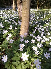
My reason for picking this walk is hopefully to catch the large and extensive Staffhurst Wood in full flower: bluebells and wood anemones (photo) being its star feature. The latter are somewhat fickle creatures, only opening up on warm days. Faute de mieux, there is one bluebell wood earlier in the walk which should definitely be in full flood, since it was already about a third out three weeks ago.

The solitary lunch pub on this walk is The Royal Oak Inn, just after Staffhurst Wood, which does have a garden if it is fine. Phoning it from the start of the walk to book a table may not be a bad idea, but if it is the weather is fine note that the pub does have a garden (booked tables tend to be inside).

After lunch the route is across low lying fields and soft ground may be an issue here if it has rained a lot in the week. This shouldn't be a problem by this stage in April, but it seems this year it is, a bit: but equally a few dry days can work wonders.

Lingfield has a tea room if you can get to it before its 5.30pm close: otherwise it has two pubs.

Trains back are at 14 and 44 past the hour to Victoria

Saturday First Walk Milford to Haslemere TOCW1.27

TOCW1 walk 27 Milford to Haslemere
11.7 miles (18.7km) rated 6 out of 10, but the proposed route is apparently easier.

There are options on this walk and I propose the route keeping to the Punch Bowl rim (para 47), and then taking in Gibbet Hill & Sailor's Stone option (para 69). This walk has had some updates and I would recommend using the download instructions for the proposed options.

The description mentions sandy bridleways and heathland as well as a number of fine views.

Travel: Take the 1015 Haslemere train from Waterloo (Clapham 1022) arriving Milford at 1105 . There is a good return service from Haslemere xx02, xx15, xx 32 and a slower xx.39 (check times after 2000). Buy a return to Haslemere. If you don't have a railcard, check the SWT £15 offer.

Lunch: Three Horse­shoes pub in Thursley (tel. 01252 703268), 5 miles from the start. I'm advised that it is worth calling to book (lunch is 12.30-14.15).

T=1.27

Friday, 15 April 2016

The Man in the Woman's Shoes at Tricycle Theatre

Pope John Paul I is not long dead, autumn is closing in and Pat Farnon has ‘some business’ to do in town. Set in Ireland in October 1978, The Man In The Woman’s Shoes follows the life of Pat Farnon as he walks to town and back again. Funny, tender and at times downright daft, this beautifully observed piece has toured across the USA and Ireland, including a sell-out run at the Abbey Theatre in Dublin.  
★★★★★ ‘Astonishing acting’ The New York Times
‘Extraordinary physical performance… sharp observational comedy’ The Sunday Times

To book, please click here. Pre-theatre F and B at The Black Lion (opposite Tricycle Theatre) from 6pm.  For menu, please click here.


Wednesday, 13 April 2016

Midweek Day Walk - Eridge Circular

Eridge Circular

A short walk through an interesting part of the High Weald

Book 3* Walk 120

* Online only

Length :  15 km or 9½ miles

Toughness :  4 out of 10

Getting there :  Catch the 10:08 am train from London Bridge to Eridge
(Departs from East Croydon at 10:23)

Meeting point :  Eridge Station at 11:03

Tickets :  Buy a cheap day return to Eridge

Brief Description

A newish walk in the delightful Kent/East Sussex countryside You may find full details here 

Suggested Lunch stops

Crown Inn, Old Groombridge t: 01892 864742
Junction Inn, Groombridge t: 01892864275 (apparently in the process of changing ownership)

Suggested Tea stop

 The Huntsman Pub t: 01892 864258 a fairly hefty stones throw from the station. Very friendly country pub, serves beer, nibbles and tea all in nice surroundings

Map

OS Explorer : 135

Return train times

Trains return from Eridge to London at the following times ... 15:50 | 16:50 | 17:20* | 17:48 | 18:20* | 18:49

* To London Victoria changing at Hurst Green
All trains stop at East Croydon, so you may choose to change there and catch a train to your preferred destination station.

Sunday, 10 April 2016

Sunday Walk 2: The Delectable Clappers

Harlington Circular SWC walk 230
17.3 km 10.7 miles. Toughness 4/10
Can be extended to up to 15.2 miles, toughness 6/10, by finishing in Flitwick.

The second of today's walks also has a literary connection. The author of Pilgrim's Progress was a native of Bedfordshire and parts of this walk follow the John Bunyan Trail across the Sundon Hills and the wonderfully named Sharpenhoe Clappers. These hills were the inspiration for his "Delectable Mountains”. After lunch in Pulloxhill, your route takes you back to Harlington, past Bunyan’s Oak, where Mr B used to preach.
Any hardnuts wanting more can opt for the full 15 mile walk to Flitwick. Slightly softer nuts can shorten that to 13.8, 13.3 or 11.9 miles.
Trains Get the Thameslink (Bedford direction) from Blackfriars at 9:24 or St Pancras at 9:34. (This train stops at a number of other stations on its way through London including East Croydon 8:56, Kentish Town 9:38, West Hampstead 9:42, Hendon 9:48). Arrives Harlington at 10:32.
To return to London.
From Harlington, xx:20  xx: 50.
From Flitwick; xx:16, xx:46
A return to Harlington will do for the circular but a return to Flitwick, the further station, costs no more and covers both endings.
Lunch
The circular and most main walk options take you to The Cross Keys, Pulloxhill, (01525 712 442).
Any taking shortcut 1 are catered for by two pubs in Westoning.
Tea
Harlington has two pubs: The Carpenters Arms (01525 872 384) and The Old Sun (01525 877 330)
Flitwick offers plenty of options for any taking the main walk, and there is an earlier recommended stop in Steppingley (see notes)
Walk Directions here
The circular walk uses the “alternative ending in Harlington”
T=swc.230.a

Sunday Walk 1: Pride, Prejudice and Water Buffalos


Overton Circular SWC walk 97
13.8km 8.6 miles
18.4km 11.4 miles with pub lunch
Difficulty 4/10
This Hampshire walk, that passes through locations associated with Jane Austen, suffered a bit of a knock when the original lunch pub closed. The walk has recently been checked and revamped and the outlying Fox has become part of the main walk, increasing its length to 11.4 miles. Those wanting to keep to the original 8.6 miles will have to picnic (for which, Steventon Churchyard makes an ideal location). Slower walkers and dawdlers may wish to join them. Water buffalo don't feature strongly in the works of Jane Austen but you are likely to see some when you go through Laverstock Park Farm (between points 57 and 61). They have a large herd - and a farm shop if you can find it.
Trains:
Get the 10:15 Exeter train from Waterloo (Clapham Jct 10:25) arriving Overton at 11:17
(Those of a jocular disposition might prefer to start from Waterbuffaloo station.)
The quickest return trains (taking 1 hr) are at 14:58 16:58, 18:58 and 20:58 from platform 1 (Note these are two-hourly intervals.)
(If you just miss one, it is also possible to return on the 15:15 17:15 and 19:15 from platform 2 changing for London at Andover. However these journeys take 1hr 45m )
You can get a cheap advance return to Overton for £15 from South West Trains details here 
Lunch: the Fox in North Waltham 01256 397 288 (There is another pub, the Wheatsheaf  01256 398 282 further away if needed - see notes) The way back from the Fox to Steventon used to be the same stretch in reverse. That's still an option but, for variety, an (as yet unchecked) route along a quiet road is now offered. 
Tea: I remember Overton as being pretty quiet on a Sunday but it's been a while. The recommended and recently refurbished White Hart 01256 771 431 is open, as is the Old House at Home en route to the station. I am told the White Hart does tea. Allow 15 to 20 mins to reach the station from Overton. Station Road is long. You still have 1.2 kilometres to go.
Directions: available here 
T=swc.97

Saturday, 9 April 2016

Third Saturday Walk

Book 2 Walk 13/SWC 57:  Guildford to Gomshall with Chantries Hill Start from SWC 57 – Historic Guildford, Glorious Escarpment Views, St. Martha on the Hill Church, Picturesque Shere and the North Downs Way

Distance:  11.8 Miles (19 kms for those metrically minded) with an option to extend to 13.8 Miles (22.4 kms) by continuing on to Boxhill

Difficulty:  5 out of 10

Train:  Take the 9:30 Portsmouth Harbor train from London Waterloo to Guildford, arriving at 10:03.  Return trains from Gomshall are at 15:53; 16:04; 17:53; 18:04; 19:53; 20:04; 21:25 and 21:55. If doing the extension to Boxhill return trains are at 28 minutes past the hour until 18:28; then at 01 past the hour until 22:01.  Buy a day return to Gomshall via any permitted route. 
This walk begins with a gentle stroll down the Wey navigation before launching steeply up Chantries Hill to St. Martha on the Hill Church.  Once on the escarpment there should be lovely views to the valley below.  The south facing slopes of the escapement and the woods on Chantries Hill are also great places for early bluebells – so keep your eyes peeled for these little beauties.   The route then continues to the charming village of Shere where there is a choice of pubs for lunch.  After lunch, the route then ascends to the North Downs Way for a loop near Gomshall where there should also be some nice bluebells on a diversion described in the walk directions before dropping back down to Abinger Hammer, near Gomshall.  For the more energetic, you can continue the walk to Boxhill.  You will need to follow the instructions from SWC 57 to point 25; then pick up the instructions from Book 2 Walk 13 at point 23.  The walk instructions and more details are available here (for SWC 57) and here (for B2W13).
There is a choice of two pubs in Shere, the White Horse (01483 202518) and the more Gastropub William Bray (01483 202044), 5.7 miles into the walk. Large groups should call ahead from the Station.
The recommended tea stop is the Abinger Tea Rooms in the village of Abinger Hammer near Gomshall.  The Compasses Inn in Gomshall is also a nice place for post walk refreshments while waiting for the train which only runs every 2 hours!  If doing the extension to Boxhill, Denbies Winery is a good a tea stop and the Stepping Stones Pub near the station also provides refreshments.
Enjoy the walk!


Saturday Second Walk [Fully Revised Walk] - SWC 58: Mottisfont & Dunbridge to Romsey

SWC 58, formerly Book 1 Walk 3: Mottisfont Abbey Gardens, West Hampshire Chalk Downs, Dun & Test Valleys and the picturesque market town of Romsey           

Length: 22.2 km (13.9 mi) [shorter options available]
Ascent/Descent: 310 m; Net Walking Time: ca. 5 hours
Toughness:  5 out of 10 (will feel tougher due to the current high mud content, especially in the woods) 

09.20 Exeter St. Davids train from Waterloo (Clapham 09.27), change at Salisbury for Chandlers Ford (arr. 10.42, platform 3 or 4; dep. 10.56, platform 6), arr. Mottisfont & Dunbridge 11.14.
[Alternatively, if you want to beat the group by 10 minutes: 09.05 Weymouth & Bournemouth train from Waterloo (Clapham 09.12), change at Southampton Airport [Parkway] for Salisbury (arr. 10.13; dep. same platform 10.25; waiting room and café across the overbridge), arr. Mottisfont & Dunbridge 11.04. We’ll catch you at the Abbey or the church…]
Book an off-peak day return to Romsey for £15 no later than the night before, on the SWT-website or at a SWT-ticket office (but not the machines)
Return trains from Romsey are at xx.07 via Southampton Airport [Parkway] (102 mins) or at xx.20 via Salisbury (118 mins).
Last train: 22.20, with a much longer journey time (just thought I’d mention that because of the high number of very agreeable tea, coffee, drink and food businesses in Romsey).

First posting of this new version of the walk, we will take the opportunity to check the walk directions.

This walk explores woods and rolling chalk hills in the Dun and (Lower) Test Valleys of remote West Hampshire. An early highlight is the NT-owned (and ticketed) Mottisfont Abbey, a historical priory and country estate, with an arm of the River Test, Hampshire's longest and finest chalk stream, running through the stunning grounds, which also include a famous walled rose garden, trompe-l’oeil murals from Rex Whistler, and several lunch options. Walk back past the 12th century St. Andrews church, one of the few Grade I-listed churches, and follow the waymarked Mottisfont Estate Path. The route incorporates all the important features of the estate, mainly varied ancient woodlands – several of which are good bluebell woods – but also some managed for timber or coppicing, historical farmland and the Dun River Meadows. After lunch in Dunbridge the route gets a little more undulating, as the Test River is followed – mostly from a distance – all the way to Romsey, a picturesque market town. You pass all its sights: Romsey Abbey, a beautiful church the size of a cathedral, the War Memorial Park, the medieval King John’s House and Tudor Cottage, some narrow historical lanes and an exhausting selection of tea and pub stops.  
Three shorter options are described, one of which follows the original Book 1 version of this walk. For details see Page 2 of the pdf. 

The lunch stop on the full walk, as well as on the second longest walk option, is The Mill Arms Inn in Dunbridge (11.1 km/6.9 mi). On the short walk options lunch is either at one of the places within the grounds of Mottisfont Abbey (ticketed entry unless NT-member) or a little off-route along the walk at either the Kimbridge Restaurant & Annie’s Tearooms or at The Bear and Ragged Staff. See Page 2 of the pdf for details. For tea, Romsey has an abundance of good quality cafes, bistros, pubs and restaurants. See pages 2, 9 and 10 of the pdf for details.

For walk directions click here. For summary, map, height profile, and gpx/kml files click here.

p.s.: if you fear getting bored on the long journey (or indeed if your favourite newspaper has just finished its print run and you got nothing else worth reading), you could do worse than downloading this excellent brochure explaining the sights along the Salisbury to Southampton line: http://www.threeriversrail.com/photos/Publications/three_rivers_line_guide_2014.pdf
T=swc.58

Saturday Walk 1 - Cookham to Maidenhead

Book 1 Walk 24 - Cookham to Maidenhead
10.6 miles/17.0km    3 out of 10

This walk heads up over Winter Hill and back to Cookham for lunch, before continuing along the Thames Path to Maidenhead.


There are various ways to shorten the route, including a finish at Cookham after 7 miles.

(The original version of this walk was a circular back to Cookham, if you have an old copy of Book 1 then please download the latest walk directions)

Trains: Take the 9:50 Oxford train from London Paddington (9:58 Ealing Broadway), changing at Maidenhead (arrives 10:35) for the 10:38 to Cookham, arriving 10:45. Return trains from Maidenhead at xx20 xx50. Buy a day return to Cookham.

Lunch: There is plenty of choice in Cookham. A few options: The Kings Arms (tel 01628 530 667) in the High Street, varied food menu offering good value. The Ferry (tel 01628 525 123), has a patio overlooking the river. Bel and the Dragon (tel 01628 521 263), pub-restaurant in a 15th century building, also on the High Street.

Tea: Maidenhead town has plenty of options, but if you would like to stop somewhere along the River Thames just before the town there are a couple of places: the up-market terrace bar at Boulter’s Lock (tel 01628 621 291) serves cream teas, while further along is Jenners Café (tel 01628 621 721) in the Riverside Gardens.

Click here for full walk details and online directions


T=1.24

Wednesday, 6 April 2016

Midweek day walk - Petersfield to Liss

Petersfield to Liss - a slightly challenging ascent onto the Hangers Way

Stunning views (weather permitting), the Hangers Way and a nice pub with real ale and good food.

Book 2 Walk 11

Length :  16½ km or 10½ miles

Toughness :  5 out of 10

Getting there :  Catch the 10:00 am train from London Waterloo (Woking 10:25 am) to Portsmouth Harbour.
Clapham Junctioneers should catch the 9:52 Portsmouth Harbour & Southsea train from that station and change at Woking to join the Waterlusians train at 10:25. At the time of writing, both trains are advertised to use platform 5 at Woking

Meeting point :  Petersfield Station at 11:00 am

Tickets :  Buy a £15 South West Trains Promotion Ticket before midnight on the day prior to the walk (Thank you for pointing that out Thomas) or a cheap day return to Petersfield on the day.

Brief Description

An ever popular walk where the Hangers is designated as an area of outstanding natural  beauty. Walkers normally take a breather at Edward Thomas's Memorial Stone towards the top of the Shoulder of Mutton hill. If the visiblity is good, the vista to the south is well worth a good look there.
There is a short cut immediately after the lunch venue, cutting 5½ km of the walk should you wish.
You may find full details of the walk here and a downloadable PDF here

Suggested Lunch stop

Suggested Tea stop

Whistle Stop, Liss t: 01730 890464 (150 metres past the station at the road junction)

Map

OS Explorer : OL33  (was Explorer 133)

Return train times

Trains return from Liss at the following times 15:02 | 16:02 | 16:23 | 17:02 | 17:23 | 18:02

Sunday, 3 April 2016

Sunday Walk 2 – A short walk in the High Weald

Extra Walk 196 – Wadhurst to Tunbridge Wells
Length: 13¾ km (8.5 miles). Toughness: 4/10

09:55 Hastings train from Charing Cross (Waterloo East 09:58, Orpington 10:19), arriving Wadhurst at 11:01. Buy a day return to Wadhurst.

Trains back from Tunbridge Wells are at 09 & 39 minutes past the hour until 19:39, then hourly.

This walk's previous outings have all been on rather gloomy late-autumn or winter days, but the Wealden countryside should look a bit more cheerful (and less muddy) in early spring. You'll get a moderately strenuous two-hour hike to a pub which advertises “a friendly welcome to walkers” and serves excellent food, followed by a shorter and easier afternoon leg to a town whose name implies it won't be short of watering holes.

The George Inn in Frant will be busy on a Sunday lunchtime and you won't get there before 1pm, so give them a call from the station when you set off. I haven't tried the village's alternative pub, the Abergavenny Arms at the bottom of the hill, but that looks pretty good too. At the end of the walk Juliets is probably the pick of the tea places in Tunbridge Wells, but even on a Sunday there should be plenty of choice.

You'll need to print the directions from the Extra Walk 196 page.
T=swc.196

Sunday Walk 1 – Gently rolling Buckinghamshire hills

Book 1 Walk 10 – Beaconsfield Circular
Length: 19.5 km (12.1 miles). Toughness: 4/10

10:15 Bicester North train from Marylebone, arriving Beaconsfield at 10:42.

There are three return trains per hour, at slightly irregular times: typically 03, 36 & 42 minutes past.

It seems odd that this Book 1 walk hasn't had a Sunday posting for over five years, since it benefits from a decent Sunday train service and a very short journey. It's in a landscape of gently rolling Buckinghamshire hills on the southern fringes of the Chilterns, with several interesting features en route: Milton's Cottage, the Quaker Meeting House at Jordans, etc.

There are mixed reports on the walk's Feedback page about the lunch pubs in Chalfont St Giles, but the original suggestion (Merlin's Cave) has been refurbished as a Charles Wells pub and looks well worth a try; you should get there around 12.45pm. A nearby alternative requiring a short detour up Silver Hill is the Fox & Hounds, or you could stop earlier at a pub mentioned en passant in para 27, the White Hart. You might be able to get tea halfway through the afternoon at Jordans, while Jungs gets a favourable mention at the end of the walk, a short distance up the main road past Beaconsfield station.

You'll need to bring Book 1 or print the directions from the TOCW1 Walk 10 page.
T=1.10