Backup Only

This Week's Walks - Archive

Please see the Saturday Walker's Club This Week's Walks page.

This is an archive of walks done by the Saturday Walker's Club. You should only need to use this page if the SWC website is down.

Sunday, 8 February 2026

Sunday walk - Dorking to Reigate

Length 12.5km (7.8 miles)Difficulty: 3 out of 10 

This mainly level walk follows the river Mole upstream from the foot of Box Hill through the picturesque villages of Brockham, Betchworth and Skimmington, ending in the grounds of Reigate Priory.

Trains: Take the 9.55 train from London Bridge (East Croydon 10.12) to Redhill  where you change to catch the 10.27 to Dorking Deepdene station arriving at 10.49. 
From London Victoria take the 9.46 (Clapham Junction 9.53) to East Croydon and change there for the above Redhill train.
Return trains from Reigate are at xx:05 and xx.29 to Redhill where there are trains to London Bridge (xx:15,  xx:45) and Victoria (xx.11). All trains go via East Croydon.
A day return to Dorking via all routes will cover both legs of the journey.

Lunch: The Dolphin Inn, Betchworth, tel 01737 842288. Best to ring and book if you'd like to eat there. Otherwise, bring a packed lunch which can be eaten in the churchyard which is close to the pub.

Tea: There are numerous cafes in Reigate. Blooms and Bakes (Cage Yard, 31 High Street) had very good cakes last time we finished there.

L=swc.16

Saturday, 7 February 2026

Saturday Walk - Henley to Pangbourne

SWC Book 1 – Walk 51: Henley to Pangbourne t=1.51

Distance: 11.9 miles or 19.2 km for those more metrically minded

Difficulty: 6 out of 10 for the main walk

Train: Take the 10:08 AM Great Western Didcot Parkway train from London Paddington, changing at Twyford (arrive 10:37; depart 10:45), arriving at Henley at 10:57. Return trains from Pangbourne are at 22 and 52 past the hour. Buy a day return to Pangbourne.

From recollection when updating this walk years ago for the republication of book 1, several stretches of it are along charming country lanes – which should hopefully limit the mud factor... Also, the route is speckled with snow drops and other bright signs of the coming Spring....  You can find more information about the walk and download the walk instructions here. 

The recommended lunch pub(s) are the Red Lion (01491 756 561) in Peppard Common 4.5miles/7.6km into the walk or the Unicorn (01491 628 674) in Kingwood 5 miles/8.6 km into the walk. Sadly, many of the other pubs on this former “pub crawl” walk have closed….

Once in Pangbourne, post walk refreshies can had at various locations -- the Swan Inn, a riverside pub by the station, is recommended….

Enjoy the walk!

Saturday Walk - Redhill Circular

Length: 20 km (12.4 miles) 4 out of 10. 4 hours 45 minutes walking time.

This new walk for a Saturday is a short train journey but comes with the author’s signature motorway warnings! The worked-out sand pits around Nutfield Marsh are gradually being transformed into wetland nature reserves or country parks and the first part of the walk takes in a succession of these lakes. The walk passes under the M23 motorway before climbing to the “vile rotten borough of Bletchingley”  The village has a wide high street, a fine parish church with some impressive monuments and a choice of two more lunch pubs. There is virtually no trace of its 12thC castle but there are fine views from Castle Hill as the walk makes its way back under the M23 to South Nutfield. Between South Nutfield and Earlswood the walk mostly follows the Greensand Way, It continues to Earlswood Common. After passing between the common's two lakes the remainder of the walk is a steady climb up and over the wooded Redhill Common and down through suburban streets to the pedestrianised town centre.


There is one shortcut before lunch and a second near the end.


Trains: Get the 0951 Thameslink train to Three Bridges from London Bridge (Norwood Junction 1002, East Croydon 1006) arriving at 1022. Frequent train service back. The two shortcut stations are the same fare as Redhill.


Lunch:  in Bletchingley, after approx 10k, 6 Miles, The Whyte Harte Hotel (01883-744356) is opposite the parish church, with a patio and walled garden at the back; Lamingtons Tea Room is a few doors away. At the top of the village on Castle Street the Red Lion (01883-743342) has an outdoor terrace and a ‘secret garden’ behind its car park.


Tea: there are several cafes in Redhill's pedestrianised central area. A Youngs pub, The Home Cottage, just past the station and a Weatherspoons in London Road.

T=swc.425

Saturday Walk - Haslemere Outer Orbital Route (Long and Short Options)

Haslemere Outer Orbital Path (sections 1-5 Marley Common to Hindhead)

Length: Length: ~18 km (~11 miles). The route can be shortened using bus stops from/to Haslemere station at the start and end or along the way - see the SWC walk page for details. Longer versions are also available (see walk directions). Sunset in Haslemere will be at 17.02, so there will be light for walking until about 17.30-17.40.

9:45 train from London Waterloo, arriving Haslemere at 10:57

Buy a return to Haslemere.

Return trains at xx:00, xx.32, xx.37

Cooper's Stream/Waggoner's Wells Ponds The Haslemere Outer Orbital Path (HOOP) passes through plenty of woodland, some picturesque areas not passed on other SWC walks, as well as some familiar areas.

Bring a packed lunch or choose from the eateries along the route: The Prince of Wales, Hammer Vale (01428 652600) 6.6 km into the route from Haslemere station. The Fox & Pelican, Grayshott (01428 604757) 12.8 km into the route. The walk notes also mention Molly's Cottage, Artisan Bakery, Grayshott (pre-order for pickup from a box on the route), 9.2 km into the route

There are places for tea in Hindhead: Café Twenty5, The Devil’s Punch Bowl Hotel, National Trust Café and a selection of pubs and cafes at the end of the walk in Haslemere.

These walks don't have a leader so you'll need to download your copy of the directions:-

If using GPS, you only need to download the GPS route from L=swc.377 page.

Note: the main written directions are on the "Relaxed Walking in the UK and Abroad" website. So, for full written instructions, you'll need to download BOTH these spoke route directions from the SWC page (for the bit between Haslemere station and the Orbital Path) AND these written directions from Neil Hook's webpage (for the Orbital Path itself).

L=swc.377

Friday, 6 February 2026

Evening Walk - Greenwich to Canary Wharf via Cubitt Town [New Walk]

Length: 4.8 km        Height Gain: negligible

Take the 18.32 Slade Green train from Cannon Street to Greenwich (calls London Bridge 18.37 and Deptford 18.43), arrives 18.45.   
You can also get to Greenwich by DLR from Bank via Canary Wharf.
 
Note: the start of the walk is not outside the main station entrance but down some steps from the rear end of the platform from London. 
 
One of three variants of a new short walk across the Isle of Dogs.We will be walking the third option mentioned below.
 
Follow quiet lanes from Greenwich Station to the Thames by the Cutty Sark, walk through the Greenwich Foot Tunnel onto the Isle of Dogs and follow any of three routes across the Isle to Canary Wharf.
The main route turns west along the Thames Path along Millwall’s riverside. Formerly the site of seven windmills, mainly for milling corn, later harbouring numerous port and heavy industry related enterprises, the path now leads mainly past new or recently built residential estates, scattered with remnants of the previous usages, while offering fine views across to Greenwich, Deptford and Rotherhithe.
A longish stretch though leads along a busy road where the right-of-way along the river has been closed a long time ago after petitioning by the former heavy industries located along that stretch.
Finally, you turn inland past the site where Millwall FC was founded and walk on to the South Dock where you cross a footbridge into Canary Wharf.   
 
Alternative routes through the Isle of Dogs are described, either inland through Millwall Park and Mudchute Park and along Millwall Outer and Inner Docks or along the easterly riverside path through Cubitt Town.


Refreshments:   
The Gun (Fuller’s), historic pub on the Thames, a few minutes before the end of the walk:   https://www.thegundocklands.com
Numerous options in Canary Wharf.
 
For detailed route maps, gpx/kml files, photos and walk directions here. (link now working).  t=short.70.b

Wednesday, 4 February 2026

Wednesday Walk - Princes Risborough to Great Missenden

T=1.45
L=1.45
LENGTH 15.8km (9.8 miles)

TOUGHNESS 5/10

TRAINS 10.02 from MARYLEBONE arriving PRINCES RISBOROUGH 10.38
Return trains from GREAT MISSENDEN are half hourly at .03 and .33
Single tickets are cheaper due to starting and ending stations being on different lines. Otherwise a return to AYLESBURY is needed. 

LUNCH
Or
The former entails a steep down and up from the route but is nearer the walk’s halfway point. 

TEA It’s got to be THE GEORGE, just where you hit the high street. There’s a Costa and an independent cafe side by side close to the station. 

Sunday, 1 February 2026

Sunday Walk: Harpenden to St Albans

17.6 km (10.9 miles) Difficulty 3/10 t=swc.351
A walk through common land, a Woodland Trust forest (Heartwood), a country estate (Childwickbury) and finally St Albans.
Lunch There are 3 pubs in Sandridge. 
The 17th century Queens Head (tel 01727 855069) at 7 Church End. Booking ahead is advisable.
The Green Man (tel 01727 854845)at 31 High Street. 
The 400 year old Rose & Crown (tel  01727 859739) at 24 High Street  It specialises in cask ales. Also, the Heartwood Tea Rooms at 27 the High Street +44 1727 641064
Tea     
The suggested tea place is the Abbots Kitchen just inside the Cathedral, which is open daily until 4 pm .
 An alternative is Abigails (tel: 01727-8560039) in the Village Arcade in the Cathedral precincts, which is open daily until 5 pm. 
Before you climb to the cathedral, the Olde Fighting Cocks (tel: 017227 865830), is one of several pubs claiming to be the oldest in England. 
Trains       
Get the Bedford train at St Pancras at 9:51 Platform B arriving Harpenden at10:18 (Other stations include  East Croydon 9:21, London Bridge 9:36, West Hampstead 9:59)
There are 4 ‘fast’ trains an hour returning from St Albans City (platform 3) with slower ones leaving  from platform 1. Get a Thameslink return to Harpenden.
St Albans Abbey station is mentioned as an alternative. There is one train an hour (xx:41 changing at Watford ) A separate ticket is required
Directions:  here


Sunday Walk: Pluckley Circular

Difficulty 1 out of 10 (maybe 2 or 3 for the longer versions)
Length 7.2, 9.2 or 11.2 miles (11.5, 14.7, or 18 km)
Pluckley in Kent’s Low Weald claims to be the UK’s most haunted village, but, so far, the ghosts have left us alone (touch wood). Our basic walk is 7.2 miles but can be lengthened using the two extensions. 
The area was the setting for the ‘Darling Buds of May’ book and TV series, and you pass the author’s former house. Many buildings have distinctive Dering windows -  a reminder of the former landowners, the Derings, as is the black horse motif.
Trains Get the 09:34 Ramsgate train from Victoria (arriving Pluckley 10:49).
Return trains at xx:37 to Victoria. Get a return to Pluckley. 
Lunch The Swan Inn in Little Chart is recommended 01233 840 702. 
There is a later pub in Pluckley the Black Horse 01233 224 224  In recent years, it branded itself as more of a restaurant than a pub, with no walk-in trade. Apparently, it has softened its stance, but it is untested. 
Tea    
Your best bet is the Rose and Crown at Mundy Bois 01233 840 048. This is on the route of both extensions and is a short diversion from the main walk. From there, allow 45-50 minutes to the station. 
The Dering Arms, 01233 840 371, opposite the station, is closed Sundays from 3:30. It’s haunted anyway. 
Directions here T=2.21 

Saturday, 31 January 2026

Saturday Walk - Amersham to Great Missenden with Moonlight Extension to Wendover

t=1.5

Length: 17km or 26km
Toughness: 4 / 10 or 6 / 10
Transport: Take the 10:27 from London Marylebone arriving in Amersham at 11:02 or the 10:00 Metropolitan Line from Baker Street arriving at 10:59. Return trains from Great Missenden at xx:03 and from Wendover at xx:27. Buy a day return to Great Missenden if not walking to Wendover, otherwise buy a day return to Wendover.

We tried this last year and it was a heroic wash-out. So, let's try this again: This is the reverse of the Great Missenden to Amersham walk with a moonlight extension to Wendover along the Icknield Way Trail. Sunset is at 16:49 (hence the latish start) and moonrise is at 14:44, ie the moon will be high in the sky throughout the night. The GPX for the extension is here.

Even if you do not want to continue on to Wendover this is a lovely walk in the Chilterns. The recommended lunch pub is the Red Lion in Little Missenden after about 11km. There are earlier lunch stops in Penn Street (The Squirrel, The Hit and Miss Inn). In Penn Wood there is an optional variation to pass by Holy Trinity Church with its octagonal tower (GPX is here)

Saturday Walk - Seaford to Eastbourne

CW2 28 Seaford to Eastbourne Length: 21.9 km (13.6 miles). Toughness: 9/10 
Shortcut option - finish at Birling Gap: 12.7km (7.9 miles) 

Catch the 9:54 from London Victoria arrives Seaford 11:19 (change at Lewes arr. 10:56, dep. 11:00). Buy a day return to Eastbourne. 

Lunch at the The Cuckmere Inn (alternatively there is a café nearby at the visitors centre). 

Due to the time of year, it may not be possible to complete the walk in daylight. (Sunset 16:48, civil twilight 17:24.) That said the route is straightforward and manageable. However if you are in any doubt then you should take the coastal bus from Birling Gap to Eastbourne. (walk distance ). 
T=2.28

Saturday Walk - Balcombe via Ardingly Reservoir - Winter Walk


Length: 16.2km (10.2 miles) - with possible sandwichistas' shortcut** of 12.8km (7.9 miles) T=swc.22

9.35 train Thameslink train from London Bridge (9.20 St Pancras, 9.24 Farringdon, 9.49 East Croydon) to Balcombe, arriving 10.16.

Note: Only the front eight carriages of this twelve-car train fit onto the platform at Balcombe, and they sometimes forget to remind you of this fact. You have been warned!

Walk directions, GPX and a map of the route available here.

There is a reason this version of the walk is called the Winter Walk, as a fair percentage of the route is on firm surfaces. Though not all, so don't wear your party shoes!!! One major exception is before and after Ouse Valley Viaduct, where there are some potentially squelchy fields.

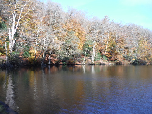
Passing under the viaduct is one of the highlights of the walk - even non-transporters will thrill at the sight - and another is the Ardingly Reservoir, which is followed for much of the afternoon and which looks very lovely in low winter sunlight (see photo: a man can dream...).

** If you are just going to eat your own sandwiches, you could have them on the benches by the reservoir and then carry on along its edge in the afternoon - this reduces the walk to 12.8km (7.9 miles).

Otherwise, there are three possible lunch options in two different places. In Ardingly village there is the Ardingly Cafe (open to 2.30: soups and toasties) and next door to it the Ardingly Inn (serving lunch at weekends as far as I know, but do check before relying on it). It is an out and back journey from the reservoir to both of these places.

Alternatively, the Gardeners Arms is the opposite direction from the village after the climb up from the reservoir. This is a deservedly popular lunch venue and it is definitely a good idea to book a table. Again, you can simply return to the reservoir from this pub to complete the walk, but another option is to follow the shortcut to Wakehurst Place, possibly have tea there, and then do the last bit of the summer route of this walk over the hills to Balcombe. This makes a total walk of 15.4km (9.6 miles), but is likely to be VERY MUDDY after Wakehurst Place.

Whatever route you take, the Half Moon pub in Balcombe serves tea and sometimes cakes, as well as drinks. 

The back route to the station is recommended (especially if skies are clear, as it is a near full moon tonight), but there is a slightly shorter route along the main road.

Trains back from Balcombe are at 25 and 55 past


Friday, 30 January 2026

Burns Night Ceilidh, Waterloo

An evening of ceilidh dancing to celebrate Burns Night, in the beautiful setting of St John's Church, Waterloo.  No experience necessary, all dance moves are explained. 

Some of SWC's top dancers will be attending, so come and join us!

Tickets £20
Doors open 7:00pm, dancing starts 7:30pm.
Full details and tickets: waterlooceilidhs.co.uk

Thursday, 29 January 2026

Evening Walk - The London Wall walk (parts thereof) with the Vibrance Festival of Light and Sound (by the Guildhall School)

The London Wall walk again, really???

Yes really, but just the first half of it to The Barbican, then we tick off the five sites of the Guildhall School’s Vibrance two-day Festival of Light and Sound extravaganza (3 of which are on the route anyway), which gets us to Guildhall Square (3.6 km walked). Then we either walk on (continue this walk, strike down to the Thames and walk some of this walk’s Roman Era Waterfront option, anything else) or retire for drink and food.  https://www.gsmd.ac.uk/vibrance         [Thanks go to Karan G for suggesting this]

Meet at 18.30 outside Tower Hill Underground Station’s Main Exit, facing Trinity Square.


Here the blurb for the normal London Wall walk:

This highly interesting walk follows as closely as possible the course of the London Wall as it would have run during Roman times around the settlement of Londinium, starting at the (medieval) fortress of the Tower of London and leading through the modern-day City of London past the sites of the former city gates to the westerly wall end at modern Blackfriars.

It also passes the site of the much older first Roman Fort (built AD 120) at the north westerly corner of the city, whose walls were later incorporated into the Wall (built ca. AD 190-230).Street levels would have been up to 7 metres lower than today, so many remaining parts of the Wall are now hidden from view in the basements of buildings or under roads, but the route still passes a surprisingly large number of publicly accessible exposed sections of the Wall above ground (plus one section below ground on an optional extension).

Wall parts as seen today have been much altered during the Middle Ages and some of the info panels or the walk directions point out these alterations. The route initially closely follows a signed London Wall Walk established by the Museum of London in 1984 for the section from the Tower to the Museum and passes the remaining info panels from that time plus several modern-day replacement panels.

At the end of the 3rd century, following a series of raids by Saxon pirates, an additional riverside wall along the Thames was added, but no evidence of it survives today. Nevertheless, two options are described to make this a circular walk, either along the modern-day waterfront or along the line of the Roman Era waterfront, which ran further inland.

Walk Options: 
Dropout points are aplenty along the route at tube stations or bus stops. 
An Extension leads to a large section of the Wall in the underground London Wall Car Park (320m each-way). 
The route can be made into a circular walk by following a choice of routes back to the Tower, both add 2.3 km to the route:
· The Thames Path along the modern-day waterfront (including several small diversions around river fronting residential or office buildings);
· A meandering route following as close as sensible the line of the Roman era waterfront.
 
Refreshments: Plenty , both en route and at the end of all walk options. Check the pdf for details. 
 
For walk directions, maps, height profiles, photos and gpx/kml files click here . t=short.47.a